
Chamdo Prefecture Attracations and Tours
Go to main page for Attractions under this link
Full Name: Chamdo Prefecture
Population: 586,000 Area: 108,600 square kilometers (41,930 square miles) Nationalities: Tibetan
Administrative Division: 11 counties (Chamdo, Jomda, Gonjo, Riwoche, Tingchen, Dragyab, Baxoi, Zogang, Markham, Lhorong, Banbar)
Seat of the Prefecture Government: Xi Lu, Chengguan Town, Chamdo County
Location: The Chamdo Prefecture is situated in eastern Tibet, neighboring the Nyingchi Prefecture in the southwest and the Nakchu Prefecture in the northwest. It is separated from the Garze Tibetan Autonomous Prefecture in Sichuan by the Jinsha River in the east. To the southeast is the Diqing Tibetan Autonomous Prefecture of Yunan, and to the north lies theYushu Tibetan Autonomous Prefecture of Qinghai.
History: Chamdo was known as 'Kang' or 'Kemu' in ancient times. More than five thousand years ago, villages first appeared in this region. During the Tubo Dynasty (7th century –9th century) in Tibet, Chamdo was the seat of the Western Qiang (Women's Kingdom) and the Supi Kingdom. The Yuan Dynasty (1271-1368) brought Chamdo into the territory of China.
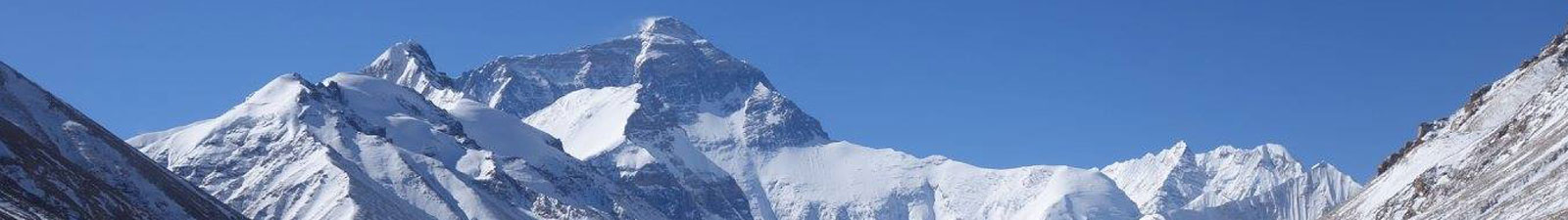
Physical Features: Chamdo lies among the upper reaches of the Nujiang, Jinsha and Lancang rivers, in the Hengduan Mountains. High mountains and plateaus make up the main part of the region.
Climate: Chamdo has a continental plateau climate characterized by low temperatures. It has two distinct seasons, a rainy season from May to September and a dry season from October to April. Its weather varies greatly due to the complex geography. For example, the southeast region of Chamdo is warmer and wetter than the north and northwest. It enjoys strong sunshine and the daylight hours are long. The temperature differs greatly between day and night. It may be rainy at night in summer and windy in winter and spring. The annual average temperature of Chamdo falls around 7.6degree (45.7).
When to Go: Places not far from the Chamdo Bangda Airport can be visited throughout the year. Land routes to other regions are usually blocked by heavy snow from November to March. It is not convenient to travel the region in July and August due to frequent rainfall. Flooding and landslides sometimes occur. Briefly, May, June and September are the most suitable for visiting Chamdo.
Local Highlights: Almost every month Chando has festivals with different themes, and some of the traditions have been passed down for many generations. The Tibetan New Year is the most important and ceremonious traditional festival of the Tibetans. New Year's Day (the first day of the first month) of the Tibetan calendar is usually in February. During the fifth and the sixth months of the Tibetan calendar, a horse racing festival is held among the locals.
In addition, monasteries hold religious festivals such as the Butter Lamp Festival in the first Tibetan month and the Saga Dawa Festival in the fourth Tibetan month. During these festivals devotees perform magnificent rituals and supplications.
Special Local Products: chang, rare herbs, Tibetan boots and knives, silver objects and decorations
Scenic Spots:
Jampaling Monastery is the largest temple in the regions around Chamdo. It was built on top of a four-terraced mesa in the 15th Century. There were more than five thousand monasteries when the monastery was at its peak. Well-preserved buildings, Buddhist sculptures and paintings make the temple an art treasury. Monasteries there are friendly to visitors. The mountain across from the monastery is the best point from which to enjoy the grand view of Jampaling and the nearby Tibetan residences.
Forty kilometers (25 miles) along the road from Chamdo County to Bangda Airport, there are several large footprints in the stone surface of a cliff. They are relics left by prehistoric animals one hundred and fifty million years ago, which the locals have always regarded as holy prints. The road to these 'big footprints' is of the best quality in Chamdo, and about an hour hour's drive from the Chamdo county seat.
Other Scenic Spots: Kanuo Ruins, Baxoi (Basu) Gaxue Rock Painting, Chagyma Hall, Karma Monastery
Travel Tips:
Located in the Bangda Grassland, the Chamdo Bangda Airport is the world's highest airport and has the longest runway. There are four flights a week from Chengdu to Bangda including a flight departing on Wednesday for Lhasa that stops in the Bangda Airport. On Saturday, a flight from Lhasa stops in Bangda and then continues on to Chengdu.
Chamdo is over 1,200 kilometers (746 miles) from Chengdu and over 1,100 kilometers (684 miles) from Lhasa. Every week at least three buses travel between Chamdo and the two cities. Apart from regular buses, the tourist bureau sometimes sends special buses to Lhasa for visitors. They do not drive at night, so the whole journey may take five or six days. For individual tourists, hiring passing cars, mostly freight cars, is the best choice. These cars usually pick up passengers at the bus station in Chengguan Town in Chamdo County, and visitors can negotiate the details with the drivers.